LATEST ISSUE
This page contains articles of the latest published issue of Geological Field Trips and Maps journal.
Volume 17 (1.2)/2025
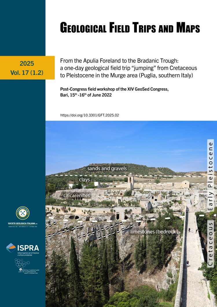
From the Apulia Foreland to the Bradanic Trough: a one-day geological field trip "jumping" from Cretaceous to Pleistocene in the Murge area (Puglia, southern Italy)
Post-Congress field workshop of the XIV GeoSed Congress, Bari, 15th -16th of June 2022
DOI: https://doi.org/10.3301/GFT.2025.02 - Pages: 1-32
Marianna Cicala1, Luigi Spalluto1, Vincenzo Festa1 & Luisa Sabato1
1Dipartimento di Scienze della Terra e Geoambientali, Università degli Studi di Bari Aldo Moro, Campus Universitario, via
E. Orabona, 4, 70125, Bari (Italy).
Corresponding author e-mail: luigi.spalluto@uniba.it
E. Orabona, 4, 70125, Bari (Italy).
Corresponding author e-mail: luigi.spalluto@uniba.it
Abstract
This one-day field trip offers the opportunity to investigate the stratigraphic and sedimentological features of an area within the
Alta Murgia National Park that includes the geographic boundary between the foreland (Murge) and the foredeep (Premurge) of
the southern Apennines orogenic system. The focus of this field trip is to show the facies associations forming the outcropping
sedimentary units and the relationships between tectonics and sedimentation. The sequence of stops follow a temporal thread
starting with the observation of the stratigraphic architecture of peritidal facies associations forming the Upper Cretaceous
section of Cava Pontrelli, an international geosite hosting one of the largest dinosaur footprint sites in the world. Then, the second
stop shows the role of syn-sedimentary tectonics on the deposition of shallow-marine carbonate deposits of the Calcarenite di Gravina Fm during the Pliocene-Pleistocene along some well-exposed natural outcrops. The third stop shows a Gilbert-type delta facies association in the Calcarenite di Gravina Fm formed at the base of an escarpment representing the structural element of conjunction between the foreland and the foredeep. This escarpment corresponds to an ancient fault plane in erosional recession formed into the Cretaceous bedrock. The last stop illustrates the historical use of local building and ornamental stones that form the UNESCO World Heritage Site of Castel del Monte.
Keywords
Adria Plate, carbonate platform, dinosaur footprints, syn-sedimentary tectonics, Gilbert-type delta, Castel del Monte, southern Italy.
